© Bayworld Ent. 2015
Brown County, WI
Rules
Hours: 5AM to 9PM
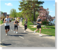
Permitted uses include:
•
Bicycling
•
Walking/jogging
•
In-line skating
•
Dogs on leashes (not to exceed 5 feet)
•
Horseback riding (in designated rural
areas)
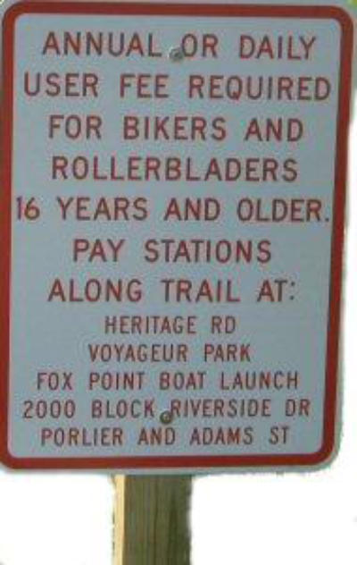
Fees: A Daily Pass or Annual State Trail Pass is
required for bicyclists, in-line skaters and
horseback riders. There is no fee for
walking/jogging on the trail or for trail users
under the age of 16. Daily passes cost $5 and are available at the trailhead and various
self-service locations along the trail. Annual State Trail Passes cost $25 and are valid at all
Wisconsin State Trails.
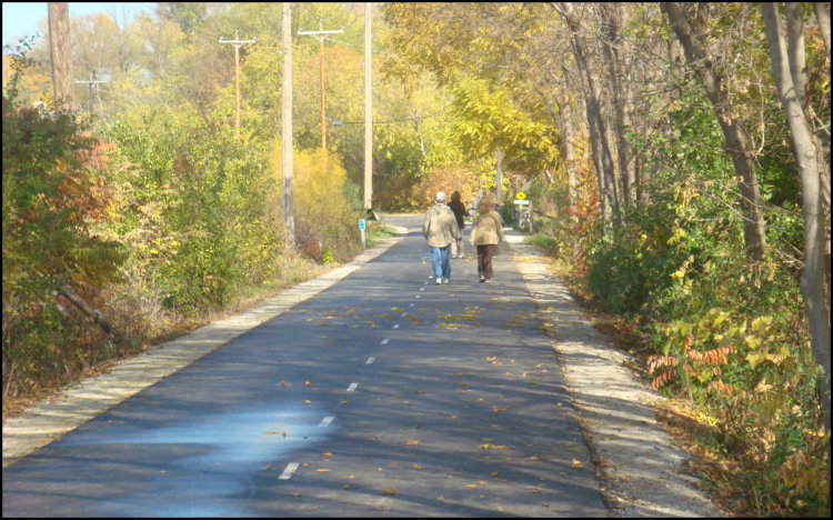
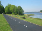
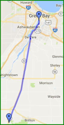
Trail overview The Fox River Trail offers a rich variety of scenery as it meanders from
downtown Green Bay along the Fox River and passes through the Brown County communities of
Allouez, De Pere, Rockland, Wrightstown and Holland. The 25 mile trail has approximately 10
miles of paved surface on the more urban section from the trailhead in downtown Green Bay
going south. The southern section is crushed stone and includes designated sections for
horseback riding. As the trail surface changes in De Pere, its path veers away from the river
passing by light industrial structures and transitioning to rural and agricultural areas on the way
to Ott Rd. just north of Hilbert in Calumet County.
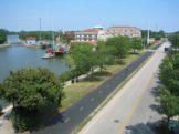
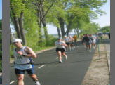
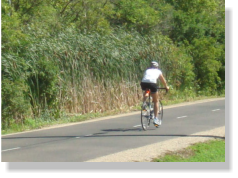
Along the way The first 3 or 4 miies of trail through Green Bay, Allouez and De Pere often has
heavy bike and foot traffic so biking at a leisurely pace is recommended. In De Pere, the trail
passes by Voyageur Park which includes a popular fishing area near the De Pere dam. On the
other side of the trail near the park is a library branch and one block east on Broadway St. is a
commercial area featuring restaurants, bars, and retail stores. Just beyond Voyageur Park is the
Claude Allouez Bridge and the De Pere lock and dam. The new Claude Allouez Bridge opened in
October 2007. The lock and dam system is one of only a few remaining manually operated
systems in the country. Boats enter a chamber on the edge of the dam where the water level is
either raised or lowered to allow continued upstream or downstream navigation. After passing
under the bridge, on the opposite bank is the over 100 year old historic campus of St. Norbert
College, a small private liberal arts college known for academic excellence.
Alernate north route The trail
officially starts near the corner of Adams
and Porlier Streets in Green Bay and
proceeds south, however, from the
starting point, the trail actually continues
north towards downtown Green Bay. The
trail transitions into a riverfront walkway
as it goes under the Mason Street bridge
then continues for several blocks passing
under both the Walnut and Main Street
bridges and continues to the confluence of
the Fox and East Rivers. With a little
maneuvering through city streets, a bike rider could proceed all the way to Bay Beach
Amusement Park, the Wildlife Sanctuary and the University of Wisconsin - Green Bay (UWGB). An
even more ambitious rider could continue past UWGB along Nicolet Dr. for a loop of over 20
miles without stopping. Nicolet Dr. east of the university has bike paths and offers great views of
the bay.
Who’s in charge The Fox River State Recreational Trail is part of the Wisconsin state park
system which is overseen by the Wisconsin Department of Natural Resources (DNR). The DNR
delegates day-to-day operational management of the trail to Brown County. Within Brown
County the Parks Department manages trail operations. This website is an independent
informational resource and has no connection to trail oversight or management.


© 2015 Bayworld Ent.

Rules
Hours: 5AM to 9PM
Permitted uses include:
•
Bicycling
•
Walking/jogging
•
In-line skating
•
Dogs on leashes (not to exceed 5 feet)
•
Horseback riding (in designated rural areas)
Fees: A Daily Pass or Annual State Trail Pass is required for bicyclists,
in-line skaters and horseback riders.
There is no fee for walking/jogging on the
trail or for trail users under the age of 16.
Daily passes cost $5 and are available at
the trailhead and various self-service
locations along the trail. Annual State
Trail Passes cost $25 and are valid at all
Wisconsin State Trails.
Trail overview The Fox River Trail
offers a rich variety of scenery as it
meanders from downtown Green Bay along
the Fox River and passes through the Brown
County communities of Allouez, De Pere,
Rockland, Wrightstown and Holland. The 25
mile trail has approximately 10 miles of
paved surface on the more urban section
from the trailhead in downtown Green Bay going south. The southern
section is crushed stone and includes designated sections for horseback
riding. As the trail surface changes in De Pere, its path veers away from the
river passing by light industrial structures and transitioning to rural and
agricultural areas on the way to Ott Rd. just north of Hilbert in Calumet
County.
Along the way The first 3 or 4 miies of trail through Green Bay,
Allouez and De Pere often has heavy bike and foot traffic so biking at a
leisurely pace is recommended. In De Pere, the trail passes by Voyageur Park
which includes a popular fishing area near the De Pere dam. On the other
side of the trail near the park is a library branch and one block east on
Broadway St. is a commercial area featuring restaurants, bars, and retail
stores. Just beyond Voyageur Park is the Claude Allouez Bridge and the De
Pere lock and dam. The new Claude Allouez Bridge opened in October 2007.
The lock and dam system is one of only a few remaining manually operated
systems in the country. Boats enter a chamber on the edge of the dam
where the water level is either raised or lowered to allow continued
upstream or downstream navigation. After passing under the bridge, on the
opposite bank is the over 100 year old historic campus of St. Norbert College,
a small private liberal arts college known for academic excellence.
Alernate north route The trail officially starts near the corner
of Adams and Porlier Streets in Green Bay and proceeds south, however,
from the starting point, the trail actually continues north towards downtown
Green Bay. The trail transitions into a riverfront walkway as it goes under the
Mason Street bridge then continues for several blocks passing under both
the Walnut and Main Street bridges and continues to the confluence of the
Fox and East Rivers. With a little maneuvering through city streets, a bike
rider could proceed all the way to Bay Beach Amusement Park, the Wildlife
Sanctuary and the University of Wisconsin - Green Bay (UWGB). An even
more ambitious rider could continue past UWGB along Nicolet Dr. for a loop
of over 20 miles without stopping. Nicolet Dr. east of the university has bike
paths and offers great views of the bay.
Who’s in charge The Fox River State Recreational Trail is part of the
Wisconsin state park system which is overseen by the Wisconsin Department
of Natural Resources (DNR). The DNR delegates day-to-day operational
management of the trail to Brown County. Within Brown County the Parks
Department manages trail operations. This website is an independent
informational resource and has no connection to trail oversight or management.